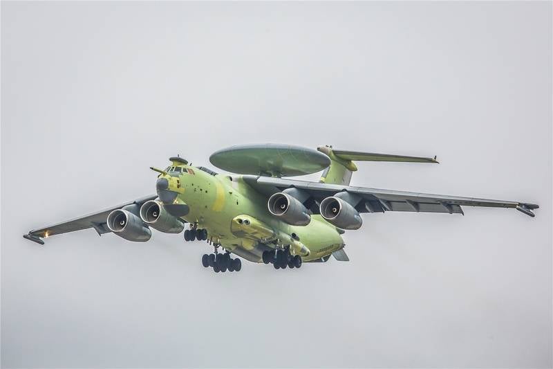
It wouldn't be able to fly very long if the loadout weighed that much. The must important factor that makes a good AWACs aircraft is loiter time.
Yes... I didn't know so that was just an estimate... but old technology radar and electronics were heavy and not particularly capable... it is getting much lighter and much more compact and there is talk of a generational shift in radar technology that might dramatically change things too.
AWACS aircraft are expensive, so if radar in satellites could do the same job why are there so many AWACS platforms in service...
Wait what ? Then what if Flight Radar doing https://www.flightradar24.com/
Besides Russian sats have regularly tracked even B-2, F-117 and F-22.
As mentioned, transponder charting in international airspace is to prevent collisions and problems, and the same for shipping too, but in a war zones most military platforms will opt out and not appear on civilian tracking systems like that, and indeed look at that radar site... where are all the drones?
Does it show military helicopters and drones too?
For a military force you need to see everything and having a platform with you that can point out things that need closer evaluation and perhaps elimination then that is what you need.
A satellite is either geostationary or it is in moving orbital position. Geostationary means it sits above the equator going around the earth once every 24 hours so it hovers in one place in the sky. If you have sky TV or some satellite TV service then you point your satellite dish at the satellite and it remains in place... it doesn't move... such satellites are very high up and their coverage near the poles is ineffective. Their coverage in mountainous areas is poor too because more often than not there is a mountain in the way unless you are on top of the highest mountain at the time.
For satellites that have a much lower orbit and give a much better view of things on earth they orbit the planet in about 90 minutes so they will be overhead for about 5-6 minutes and then they can't see you for about 85 minutes till they come back over and they wont come over on the same path... because the world is spinning so the next time they might only be visible for 2 minutes and then not be visible for a day or two... unless you have a huge number of satellites... and even then small drones will be invisible to them anyway.
AWACS and JSTAR type aircraft offer persistence and resolution that satellites can't compare with and in the near future their sensors are just going to get better and better...
No other sensors apart from these, isn't it ?
Who knows what they are carrying.... and even if they don't carry anything else... isn't that enough?
Anything you can put in a half a ton satellite you can put in a large plane or airship.
Hell a 500m long airship could probably have enough solar panels to operate without any other power source except in polar regions in winter...
A 1MW nuclear battery used to power that laser could be carried... hell put three of them on board... one at the front and one in the middle and one at the back and when there is no sunlight they could charge the batteries and convert water ballast to hydrogen gas when needed... a gas turbine running on hydrogen gas or just hydrogen fuel cells could be used otherwise to generate electricity to run electric motors to move the airship around and power the radars and sensors at night and during the day solar power could run everything... hell there would probably be a huge electricity surplus... having a huge flat solar panel surface on top you could operate electric UAVs that take off and land on the top of the airship... the airship could be wing shaped to make it more aerodynamic and also greatly increase the upper surface area for solar panels.
You could use solar panels optimised for UV frequency light which occurs 24 hours a day, so it could even generate power at night, though not as much as during the day of course.
Most of its time it will be operating above the clouds so max power to those solar panels...


